Codice
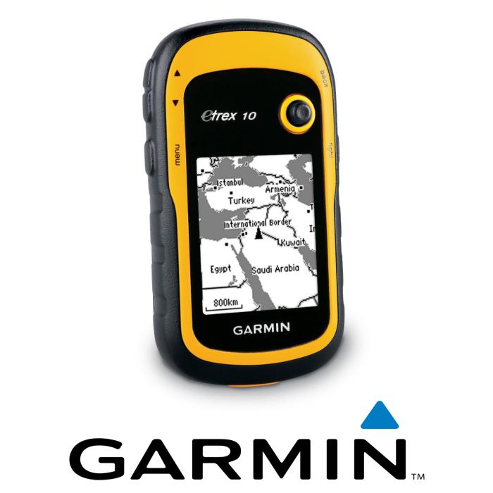
TECHNICAL FEATURES: • World base map
• 2.2 "black and white screen, easy to read in any lighting condition
• GPS and GLONASS satellites for faster location
• TracBack® function
• Battery life of 25 hours with 2 AA batteries
The new eTrex 10 retains the main features, the robust structure, the long battery life and the quality / price ratio that have made eTrex the most popular GPS device on the market. The user interface has been improved and worldwide basemap, computerized geocaching has been added, and accessories for handlebar mounting have been made compatible. Same name. Same quality. However, eTrex 10 is a completely new device, which only Garmin could offer.
- Display of the route The eTrex 10 device features a 2.2 '' monochrome display that is easy to read in any lighting condition. Rugged and waterproof, eTrex 10 is designed to withstand the elements. The easy-to-use interface allows you to spend more time outdoors, reducing information search times. eTrex 10 is equipped with the necessary resistance to resist elements such as dust, humidity or water, none of which represents a challenge for this formidable navigator.
- Fun
eTrex 10 supports geocaching GPX files for downloading geocaches and details directly to the unit. To start the adventure with geocaching, visit OpenCaching.com. eTrex 10 stores and displays key information, including location, terrain, difficulty, tips and descriptions; in this way, it will no longer be necessary to manually enter the coordinates and print the maps. Just load the GPX file onto the drive and start the cache search.
- Maintaining the position With the WAAS-enabled high sensitivity GPS receiver and HotFix® satellite forecasts, eTrex 10 pinpoints your position quickly and accurately and maintains it in covered areas and mountainous areas. The advantage is obvious: when you are in a dense forest or simply near tall buildings, eTrex 10 will be able to work out a route at the most appropriate time.
- Advanced surveys The new eTrex series is the first to detect both GPS and GLONASS satellites simultaneously. GLONASS is a system developed by the Russian Federation that will be fully operational in 2012. When using GLONASS satellites, the time taken by the receiver to detect a position is (on average) 20 percent less than GPS. In addition, when using both GPS and GLONASS satellites, the receiver is capable of receiving signals from 24 satellites more than the GPS system alone.
Rediscovering the adventure
  | Computerized geocaching
Spend more time on the field and less time wandering through the sheets! ETrex stores and displays key information, including location, terrain, difficulty, tips and descriptions; in this way, it will no longer be necessary to manually enter the coordinates and print the maps. Just load the GPX geocaching file into the drive and start looking for caches. |
  | Receive the signal from multiple satellites
Find your way with the first user GPS receiver that simultaneously receives the GPS signal and the signal from the GLONASS satellites of the Russian Federation. Using the two signals together, the receiver is able to detect 24 more satellites than GPS alone, locating positions more quickly. |
  | New interface
Find what you are looking for more easily. The new eTrex is easier to use, thanks to more intuitive navigation screens. |
  | Choose your profile
Customize eTrex for any occasion. Profiles allow eTrex to quickly switch to other user-created configurations; therefore at the end of the geocaching activity, when you return home, the eTrex will always be up to par. |
  | Multiple control panels in multiple screens
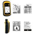
Add features to popular applications with custom control panels. Avoid always switching between applications and view more information, customizing control panels by adding altimeter, compass, configurable data fields and more. |
  | Advanced detection
ETrex offers all the necessary functions both when following a saved route and when creating a new route. The user can view the high and low altitude points or save waypoints along a route (start, end and high / low altitude) to estimate the time and distance between the different points. |
New device: name and quality unchanged
- The device saves data in GPX files compatible with a wide range of computer applications; offers even better results with Garmin BaseCamp ™'s free route planning software.
- It includes a world base map, a better interface and can be mounted on the frame.
- It is extremely resistant to dust, dirt, humidity or water.
- It locates the GPS position quickly and precisely and maintains it even with reduced coverage and in deep canyons.

